 By Àlex S.Casanovas
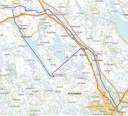
MAP
66ºNorth Ultra Race 20.-22 February 2015

During the briefing, organisation will give you a map like this one in DIN A3
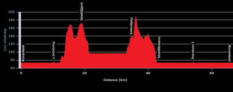
66ºNORTH CHECKPOINTS LIST
All waypoints are approximately
Waypoints Grid: Lat/Lon hddd.ddddº
Waypoints Datum: WGS 84
POROHOVI 1, shelter, camp fire and water.
N66.58602 E25.64026
10,9 km.
close saturday at 11:30 h.
SINETTÄJÄRVI, notthing but the control.
N66.55343 E25.49260
(10,3 km) 21,2 km.
close saturday at 14:00 h.
MELLAVAARA, tent and camp fire.
N66.65534 E25.32711
(14,4 km) 35,6 km.
close saturday at 18:00 h.
SINETTÄNLAAVU, shelter and camp fire.
N66.64490 E25.48876
(9,6 km) 45,2 km.
close saturday at 21:00 h.
POROHOVI 2, shelter, camp fire and water.
N66.58602 E25.64026
(9,7 km) 54,9 km.
close saturday at 24:00 h.
ROVANIEMI
(10,9) 65,8 km.
close sunday at 03:00 h.
